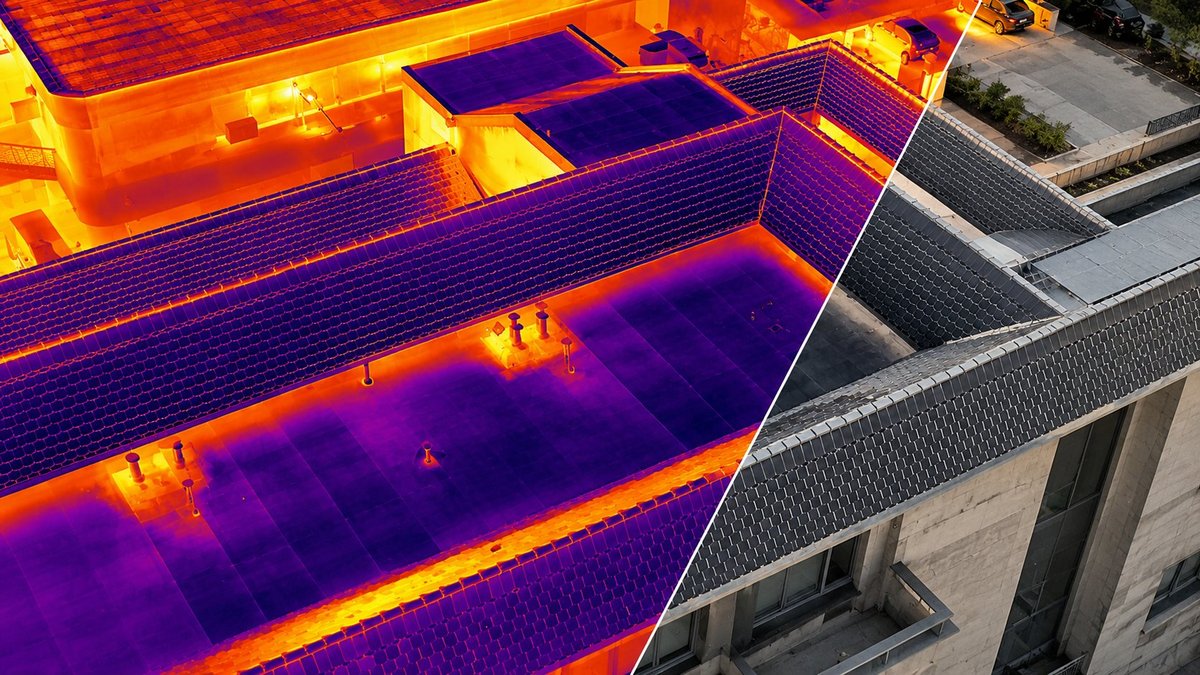
Heat losses, faulty photovoltaic cells, structural damage and georeferenced aerial maps — documented precisely from the air, with no scaffolding and no downtime.
The drone's thermal camera sees what the eye cannot: thermal bridges, water ingress, areas with failed insulation. The essential data before an energy refurbishment — or the proof that the work was done correctly, at handover.
Thermal map of the entire envelope, roof included
Prioritize the investment: repair first where most is lost
Objective verification at the handover of envelope works
photo + thermal reportlocated defectsoptional: 3D model
It can be carried out all year round: in winter for thermal bridges and heat losses, and in the warm season in the evening, after sunset, for water ingress and damp.
THERMOGRAPHY · REPORT PER PANEL
SERVICE 02
Thermal inspection of photovoltaic parks
For: park operators · companies with rooftop PV · investors
A faulty cell means yield lost every single day. We fly over the park and quickly identify the cells and strings with problems — hot spots, faulty diodes, shading — with a report on every panel.
Hundreds of panels checked in a single day of flying
Yield recovered: you know exactly which panel to replace
Periodic inspections for warranties and insurance
report per panel / stringclassified severitylocation map
The ideal moment: sunny days — panels under load reveal their defects.
STRUCTURAL · PHOTOGRAMMETRY
SERVICE 03
Assessing damage to buildings & infrastructure
For: technical assessments · facility management · public administration · industry
We inspect roofs, tall facades, chimneys, industrial halls and electrical infrastructure — dangerous or inaccessible areas — and document photogrammetrically every crack, corrosion or degraded element, with precise localisation.
Full access to areas that are hard or risky to reach on foot
Historical documentation: compare the condition year over year
The perfect complement to the 3D digitization of the building
high-resolution photosmarked defectsoptional: centimetre-accurate 3D model
For: town halls and local councils · green space registers · parks and leisure areas · industrial platforms · agriculture
We fly the drone over your area and stitch hundreds of photographs into a single high-resolution aerial map, positioned in real-world coordinates. In practice, you get an overview you can measure on directly — lengths, areas, distances — and over which existing plans and documentation can be overlaid, with no new trip to the site.
Georeferencing in real-world coordinates (WGS 84 / UTM zone 35N), with centimetre accuracy through RTK correction
Hundreds of hectares covered in a single flight campaign, in days instead of months
A working base for the green space register, the public domain inventory and urban planning documentation
Repeatable over time: compare two flights and see exactly what changed from one year to the next
georeferencing WGS 84 / UTM 35Ncentimetre accuracydelivery GeoTIFF · DWG · PDFoptional: 3D model of the area
We deliver the format your project needs: GeoTIFF for GIS software, DWG for CAD design and, where required, the 3D model of the area.
Why by drone
Classic inspection vs. drone inspection
Classic inspection at height
ELY BASS drone inspection
Access
scaffolding, lifts or rope access technicians
any roof or facade, straight from the air
Duration
days of assembly + inspection
a few hours of flying
Safety
working at height = permanent risk
nobody working at height
Building activity
often interrupted
carries on as normal
Documentation
scattered notes and photos
report with every defect located + optional 3D model
What the eye misses
stays unseen
the thermal sensor shows the invisible losses
Frequently asked questions
Good to know before the inspection
When is a building thermography survey carried out?
Thermography can be done both in winter and in summer — what matters is the temperature difference between surfaces. In winter, the indoor–outdoor difference reveals thermal bridges, heat losses and poor insulation. In summer and in the warm season, flights are usually done in the evening, after sunset: surfaces release the heat absorbed during the day at different rates, which exposes water ingress, damp areas, detached render or failed waterproofing. For photovoltaic parks, the inspection is done on sunny days, when the panels work at full capacity.
What do I receive after the inspection?
A photo and thermal report with the precise location of every defect, plus recommendations. Optionally, a 3D model of the building with centimetre accuracy.
Does activity have to stop?
No — the inspection is done from the outside, with no scaffolding, no rope access technicians and no interruption of your activity.
How large can the inspected object be?
From a single house up to photovoltaic parks or entire complexes — flights are planned by zones, and hundreds of panels or thousands of m² of facade are covered in a single day.
Book the inspection before the defect becomes a problem.
Tell us what you want checked and you get the quote within a maximum of 48 hours.